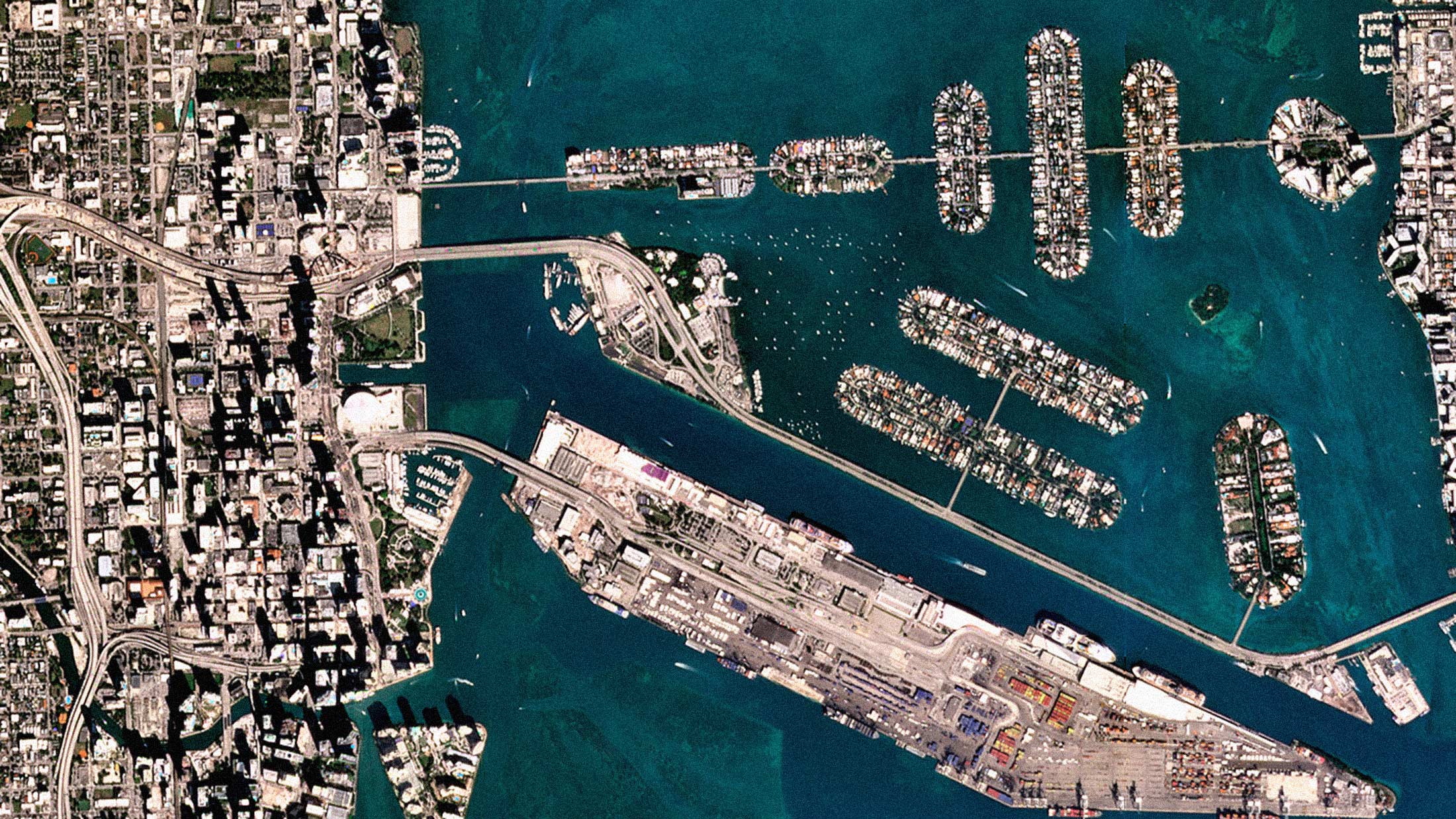
Planet Labs has released Planet SuperRes, an AI-powered enhancement product that upscales the company's near-daily PlanetScope imagery from approximately 3 meters to a sharper 2-meter resolution. The system uses artificial intelligence to analyze PlanetScope imagery and add a new layer of detail, resulting in what Planet describes as a sharp 2-meter resolution visual solution.
The underlying technology is an Enhanced Super-Resolution Generative Adversarial Network, or ESRGAN. Planet assesses the effectiveness of the model using a 1.5x scaling factor. The primary differentiator, according to Planet, is a proprietary collection of more than 120,000 SkySat and PlanetScope satellite image pairs. The training dataset pairs 3-meter PlanetScope scenes with 0.5-meter SkySat ground truth images of the same locations.
The Confidence Layer
What separates SuperRes from typical upscaling software is transparency about its limitations. Planet SuperRes provides an accompanying Confidence Layer that highlights which parts of the image the model is confident about and which parts may be generating hallucinations.
In AI, a hallucination isn't a random error but the model's best-educated guess to fill in details when the original image lacks enough information for a definitive answer. It might render a plausible shape for a truck in a distant parking lot. In one example, the model produced a texture that is plausibly a parking lot but hallucinated individual cars with incorrect shapes or orientations. The Confidence Layer correctly flagged these areas with low confidence.
This kind of built-in uncertainty quantification is rare in commercial AI products. Most companies ship models with confident-sounding outputs and leave verification to the end user.
Where It Works, Where It Struggles
In dense urban areas, the model can sharpen large buildings so well that rooftop text becomes legible where it was previously indistinct. It excels at defining sharp corners, clean lines, and distinct shadows on infrastructure. In forested areas, a green canopy resolves into individual trees. In agriculture, crop field boundaries become clearer, helping identify different crop types or irrigation patterns.
Enhanced image quality can be helpful for agricultural monitoring, forestry, and defense and intelligence applications. The model has some difficulty with dense clusters of very small objects, like cars in a crowded parking lot.
Planet will offer basemaps created from SuperRes imagery, providing what it calls a seamless, high-definition upgrade for customers who rely on monthly basemaps for consistent wide-area monitoring. For more targeted needs, users can run the SuperRes model on imagery within their data collections in Planet Insights Platform to enhance specific PlanetScope images over unique areas of interest.
The Surveillance Question
Every advance in satellite resolution reignites a familiar debate. A growing share of Earth can be captured from satellites in near-real-time and in ever-greater detail. In 2024, the US Geological Survey identified some 472 earth observation satellites in orbit, 202 operated by governments and 270 by private operators.
Satellite technology may be employed to violate individual privacy rights in many ways, including through surveillance. Satellites can monitor an individual's movements and schedule. While technology is not yet advanced enough to capture faces, identification by aggregating multiple discernible features in an image is possible. Contextualizing satellite imagery in reference to geographic locations can transform an individual in an image from arbitrary to distinguishable.
The legal framework has not kept pace. There is uncertainty about whether enforcement agencies need search warrants or authorization to acquire imagery. Satellite monitoring does not fall easily within existing safeguards because it is the company that owns the satellite that is actually undertaking the monitoring. The fact that satellites continually orbit the globe collecting data means that any images taken in a routine sweep might not be classified as directed surveillance.
More widespread and intensive use of earth observation data and its technological convergence with artificial intelligence raise new concerns about national security, privacy, and ethical data use. As part of the growing trend of digital disinformation, trust in satellite data can be eroded by fake, misinterpreted, or intentionally misrepresented imagery. In 2025, there were several examples of deepfake satellite imagery used to exaggerate the effect of military strikes.
Useful Technology Deserves Clear Rules
Planet's SuperRes is a genuinely useful product. The applications in environmental monitoring, disaster response, and agricultural science are substantial. The company's decision to ship a confidence layer that explicitly flags where the AI is guessing rather than reporting shows a level of transparency that others in the industry should emulate.
But the broader trend is worth watching. AI enhancement doesn't change what the satellite actually captured. It makes existing data more useful. And as AI-powered analysis tools get layered on top of this imagery, the gap between what's technically possible and what's legally regulated continues to widen. Governments can take steps to help maximize positive impacts while minimizing potential risks, but so far only a small number of OECD countries have explicit earth observation data regulation in place.
Planet's SuperRes works. The question for policymakers is whether the rules will catch up before the resolution does.