A new platform from Boston-based Graylark Technologies promises to turn any image into location intelligence in seconds, with no metadata required. Called Raven, the tool is the rebranded version of GeoSpy, which gained attention after launching on Christmas Eve 2023 and quickly spread through the OSINT community. Now, Graylark is pitching it directly to law enforcement, government agencies, and enterprise investigators.
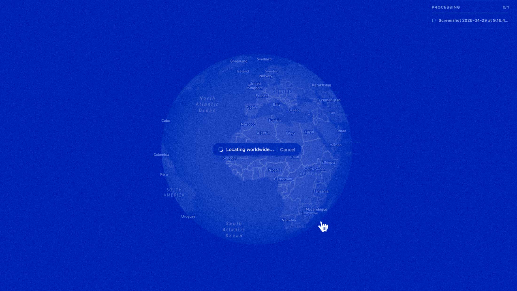
According to the company's website, Raven uses AI to read every detail in an image and return what it describes as high-confidence intelligence. The system's vision transformer breaks down a single frame into components like vegetation, soil, architecture, and sky patterns, then infers a region from those signals. No GPS coordinates or EXIF data are necessary.
Three Intelligence Modes
Raven currently offers three distinct capabilities. Geoestimation analyzes environmental and structural context to return ranked, high-confidence regional matches. Street Targeting refines those broad results down to meter-level precision, even when obvious landmarks are absent. And a vehicle identification module examines body lines, materials, trim, and interior details to match vehicles against a learned database, returning make, model, and year with ranked confidence scores.
All of this feeds into a shared case system. Every geolocation, vehicle ID, and operator annotation is layered onto a single map, with the platform automatically clustering high-confidence leads and measuring proximity between sources. The goal is to eliminate the hours of manual correlation that would otherwise slow down an investigation.
Law Enforcement Adoption
Graylark has restricted Raven to verified agencies and investigative teams. As 404 Media reported, the Miami-Dade Sheriff's Office and the Los Angeles Police Department have purchased access to the technology. Internal emails from the Miami-Dade Sheriff's Office obtained by the outlet described GeoSpy as a promising tool for developing investigative leads by identifying geospatial and temporal patterns. The agency's Cyber Crimes Bureau has been piloting the software, with officials cautioning that outputs should be treated as lead information and corroborated through standard investigative methods.
The company claims its custom models can achieve accuracy within one to five meters in supported cities. That level of precision, combined with the ability to work from images stripped of metadata by social platforms and messaging apps, represents a significant capability shift for investigators.
The OSINT Divide
What Raven automates would traditionally require years of open-source intelligence training. Skilled OSINT professionals have long analyzed architectural styles, vegetation patterns, and street furniture to locate photos manually. This tool collapses that expertise into seconds. The implications cut both ways: faster leads for legitimate investigations, but also the potential for misuse if access controls fail.
Graylark itself has acknowledged the stakes. After privacy concerns arose when GeoSpy was publicly available, founder Daniel Heinen shut off open access and pivoted entirely toward law enforcement sales. The company's messaging now frames Raven as a frontline tool for public safety and national security.
Whether that framing holds depends on how agencies deploy it. The technology works. The question is who gets to use it and under what oversight. For now, Graylark is betting that restricting access is enough. Investigators can book a demo through the company's site to see Raven run on their own imagery.